We take distances for granted. They’re marked on highway signs that whiz by at 70 miles an hour — 205 miles to Asheville, 83 miles to Kansas City. And, as adults, we run shorter distances and know what that feels like — 5k, 10k, 13.1 miles. Some people even know what it feels like to run 100k.
But most of the journeys that we read about in history classes traverse distances that go way beyond the scale of our everyday imagination. Who can relate to weeks and weeks of walking nearly 2000 miles on the Oregon Trail?
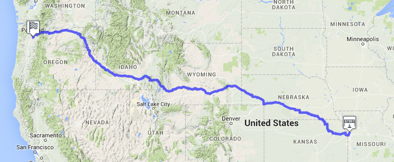
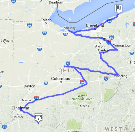
To help history or geography teachers convey a little of what such a journey would feel like, we’ve started creating virtual races on maps of famous treks. We’re starting with maps of the Oregon Trail and the Underground Railroad in Ohio.
How would a class use this? Pooling their exercise mileage, a class of 25 fifth graders should, in theory, be able to cover the Oregon Trail in four to eight weeks. More ambitious classes can break into 10-person teams and go further per week… or longer. Here’s where students can register to start slogging along the virtual route of the Oregon Trail. Porridge and ponchos are optional, of course.