
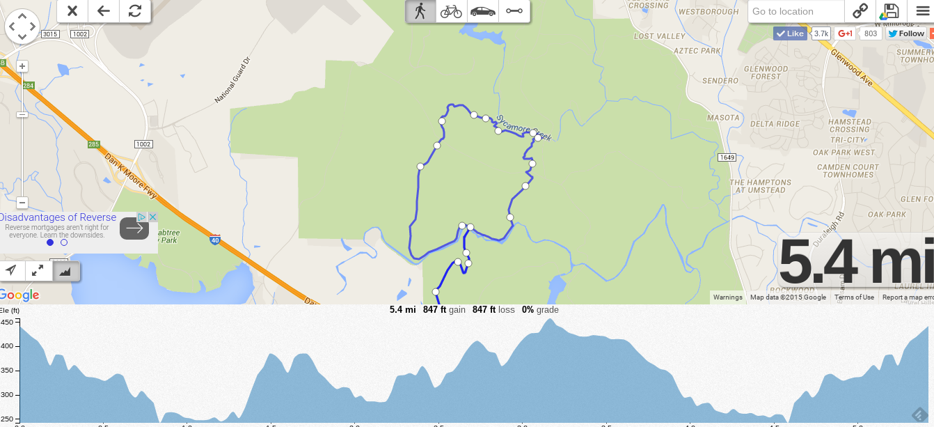
If you’re looking for an awesome tool for mapping out a running or cycling route, we recommend OnTheGoMap. It took just a few clicks to create this map of one of favorite local trails, including the optional elevation plot. And here’s a link to the same map.
We’ve compared it to tools like Mapometer, PlotMyRoute, PlotaRoute, Gmap-Pedometer and find OnTheGoMap has the perfect blend of simplicity and power. Thoughts from the Reddit community here. As you’ll see, your mileage may vary. 🙂
Give it a try and let us know what you think.